
The Building Resilient Communities theme includes projects that encompass a variety of decision-making processes, to include assessing and advising on issues associated with natural hazards; planning for hazard mitigation, disaster recovery, and developing indicators and metrics measuring disaster recovery outcomes; and creating tools to convey findings.

Building Community Resilience Through a Nation-Wide University Network and International Learning Laboratory
This project will develop and institutionalize an International Learning Laboratory, focusing on the identification of best practices advancing hazard mitigation grants management and planning activities.
Coastal Hazards Analysis, Modeling, and Prediction System for Emergency Planning, Management, and Response
This project resolves a critical information blind-spot, i.e. local level short-term hazard forecasts, and thereby enables emergency and facility managers to pinpoint vulnerabilities and take actions to mitigate them in the days and hours before a severe storm or tropical storm strikes.
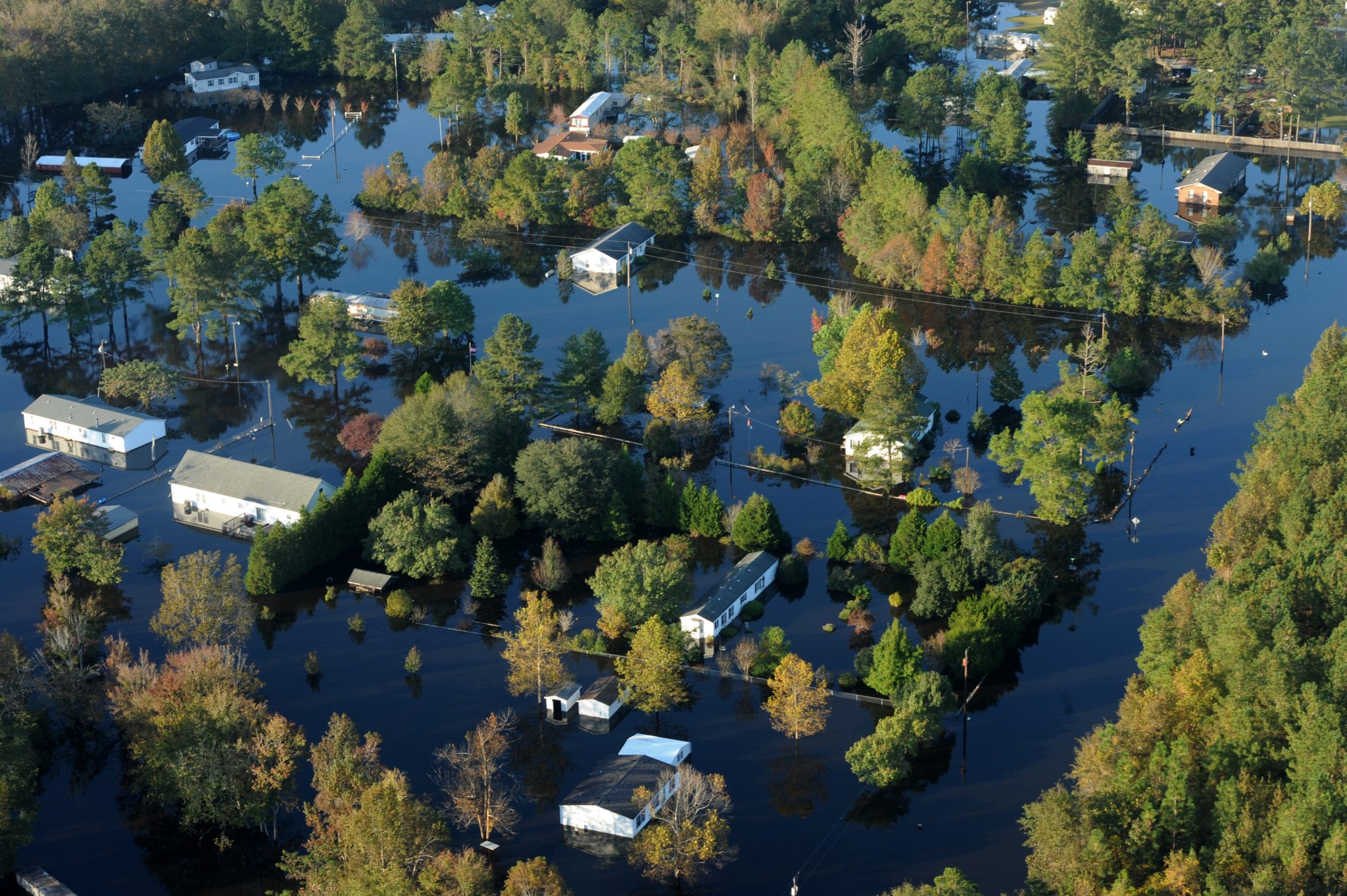
Community-Level Decision-Making for Coastal Mitigation
Adoption of The 500-Year Design Flood. We will analyze the impact of coastal flooding for the communities of Lumberton, NC, and Fort Myers Beach, FL, both of which have been impacted by hurricane floods.
Evaluating Coastal Adaptation Strategies in the Face of Chronic and Extreme Events
This project evaluates the effectiveness of coastal adaptation strategies at reducing chronic and extreme flood risk in the face of sea level rise.
Identifying Obstacles to Flood Mitigation Funding
This project combines two novel datasets to analyze the full pipeline from flooded to funded.
Landscape Study of Data Needs and its Access and Availability to Support Community Resilience
Our research aims to provide insight into transforming the disaster risk management community so that effectiveness is an embedded practice that encapsulates all needs, including the needs of the most historically impacted.
Listening to the Academic and Community Experts on Preparedness for Natural Hazards
Our research aims to provide insight into how NGOs and government officials support historically impacted communities through a hazard.
Plan Integration for Resilience Scorecard
The Plan Integration for Resilience Scorecard™ (PIRS) assists local practitioners to assess the degree to which networks of local plans target geographic areas most prone to hazards and spatially evaluate the coordination of local plans.
Completed Projects
An Interdisciplinary Approach to Household Strengthening and Insurance Decisions
This interdisciplinary project improved a developing tool to help agencies explore the potential effects of policies related to household hurricane risk reduction.
Buyouts, elevating, and floodproofing
In this project we propose to model two communities, one inland and one coastal, with a suite of flood scenarios.
Communicating Risks to Motivate Individual Action
This project applies the Transtheoretical Model (TTM), a widely used behavior change model developed at the University of Rhode Island and applied successfully to over 40 health risk behaviors.
Community Supply Resiliency (COMSURE)
The resilience of a coastal community to an extreme event depends upon the resilience of its critical infrastructures, one of which is the system of supply chains that provide the goods and services that make a community livable – Community Supply Resiliency.
Flood Apex Program
The CRC partners with the Department of Homeland Security Science & Technology Directorate (DHS S&T) on a program that aims to save lives, reduce property loss and enhance resilience to disruptive flood events.
Hurricane Matthew Disaster Recovery and Resilience Initiative (HMDRRI)
HMDRRI involves the university engagement of faculty and students as well as professional planning experts in addressing community and state-level needs associated with recovery from Hurricane Matthew.
Implementing the Disaster Recovery Tracking Tool
The Disaster Recovery Tracking Tool is a web-based tool that enables end users (e.g., planners, emergency managers, long-term recovery committees) to track the progress and quality of post-disaster recovery by comparing baseline and post-disaster data.
Integrating ADCIRC™ Prediction System Tools to Support HAZUS Damage Assessments and Planning Efforts for More Resilient Communities
We will build on previous research integrating ADCIRC Prediction System results with Hazus flood exposure and damage modeling techniques to evaluate the impact of natural hazards to improve planning.
Joint Port Resilience Assessment Project
This project was established to develop a Port Resilience Assessment and Decision Guide to provide a holistic understanding of port operations, the infrastructure systems that support these operations, and analysis methods that can be utilized to understand functional resilience and support investment and other decisions.
Operationalizing the Coastal Hazards Overlay District and Hazard Transect
The Coastal Hazards Overlay District Guide will provide actionable information to communities as they seek to reduce natural hazards risk and adapt to a changing climate by providing the tools needed to apply a series of risk reduction measures in coastal communities that are already located in vulnerable locations.
Overcoming Barriers to Motivate Community Action to Enhance Resilience
This project is designed to improve our understanding of how to overcome the “adaptation deficit” within the context of community preparedness for coastal storm hazards.
This material is based upon work supported by the U.S. Department of Homeland Security under Grant Award Number 2015-ST-061-ND0001-01. The views and conclusions contained herein are those of the authors and should not be interpreted as necessarily representing the official policies, either expressed or implied, of the U.S Department of Homeland Security.